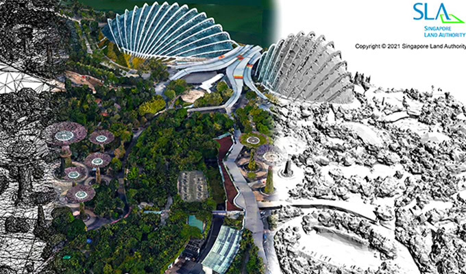
Singapore Land Authority initiated a 3D reality mapping project to update its 2014/2015 national 3D map, improving accuracy and accessibility to government agencies and stakeholders. Covering a 720-kilometer area consisting of over 160,000 high-resolution images, the scale presented data processing challenges compounded by data interoperability difficulties among numerous agencies using varying legacy systems. They explored third-party software applications, but needed a comprehensive, interoperable reality modeling and mapping solution to deliver a cloud-based digital twin.
They selected ContextCapture to generate a 0.1-meter accurate nationwide reality mesh and Orbit 3DM to incorporate over 25 terabytes of data covering all public roads in Singapore, resulting in a sustainable digital twin for a variety of nationwide infrastructure projects. Compared to traditional methods, Bentley technology saved SGD 29 million and one year and four months, generating a dynamic, national 3D reality mesh while increasing user accessibility by 60%. The project promotes digital transformation and development of Singapore.
